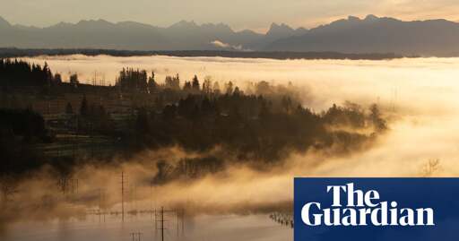
You didn’t even have to read the article… the name Washington State is in the title. We refer to Northern California Oregon and Washington as the Pacific Northwest. It’s an article about america and it mentions Canada. I consider BC Canada to also be in the Pacific Northwest as it is part of the region and shares similarities in geography and climate.
Basically the north shore is in the Arctic Circle. The vast majority of Alaska is in the Pacific. As is all 1200 km (27 000 km of coastline) of British Columbia.
It is a body boarding on two distinct zones and is therefore treated special in everything from Cartography to Geography and Meteorology. That’s just the way it is.

I don’t understand why the term Pacific North-west is used. Alaska is the Pacific north-west.
They’re referencing the contiguous United States. Otherwise, the Southwest would include Hawaii too :3
I guess it would be awkward to say Contiguous United States Northwest Pacific. It needs another name.
It would be weird to call it the Pacific Mid-West.
Why?
The mid-west is where the great plains begin. It would be like calling Maine the mid-east.
i’m pretty sure the great plains are where the great plains begin and the midwest starts closer to Ohio
Or it could start closer to Denver depending on if you’re a glass half full or empty type.
Lyrics from a song, just a quote.
You mean the mid-west United States? It would be nice to include a country in this international site.
You didn’t even have to read the article… the name Washington State is in the title. We refer to Northern California Oregon and Washington as the Pacific Northwest. It’s an article about america and it mentions Canada. I consider BC Canada to also be in the Pacific Northwest as it is part of the region and shares similarities in geography and climate.
This is about the Pacific Northwest, is that not clear? If you’ve never heard of it now you have.
You are correct in many ways. The Nortwest Passages north of Hudson Bay is also technically the Northwest.
However, since parts of Alaska along with Canada are technically the Arctic Circle, they are excluded.
Basically the north shore is in the Arctic Circle. The vast majority of Alaska is in the Pacific. As is all 1200 km (27 000 km of coastline) of British Columbia.
Thus why I specifically cited ‘parts of’.
It is a body boarding on two distinct zones and is therefore treated special in everything from Cartography to Geography and Meteorology. That’s just the way it is.